Ryan Benhatta — Year 2, Applied Science
Abstract
Urban stormwater runoff can transport pollutants from roads, sidewalks, parking lots, and rooftops into nearby waterways, making it a large indicator of local environmental quality. This project tested stormwater from five catch basins from comprehensive development, residential, commercial, and industrial land uses. Two rounds of data collection were completed for each site and the samples were analyzed with test strips for pH, total alkalinity, total hardness, zinc, free chlorine, iron, QAC & QUAT, copper, lead, mercury, nitrate, nitrite, total chlorine, manganese, sulfate, and fluoride. Most non-industrial sites showed similar readings, with low or zero values for most contaminants. However, industrial sites consistently showed worse water quality with higher levels of alkalinity, total hardness, nitrate, nitrite, and sulfate. These results support the idea that industrial and traffic-related land uses contribute to decreased stormwater quality than residential or mixed-use areas and can have severe implications to ocean ecosystems and the environment.
Introduction
Managing urban stormwater runoff is a significant environmental challenge in most green cities, as it carries a range of pollutants from places like streets, sidewalks, parking lots, and rooftops into local waterways through the stormwater drains. Vancouver consists of residential, commercial, industrial, and mixed-use land areas, and understanding how water quality varies by land use is essential for preserving public health and ecosystems in order to respond and treat pollution.
Urban stormwater runoff is created when precipitation flows over impervious surfaces (concrete, roofs, roads) instead of soaking into the ground or environment, resulting in the transportation and accumulation of heavy metals, nutrients, suspended solids, hydrocarbons, and microbial pathogens (Yazdi et al, 2021), which can all cause harm to the environment. Unlike municipal wastewater, which undergoes treatment to remove contaminants, stormwater in most cities including Vancouver is sent from storm drains where it is collected directly into the ocean, serving as a primary vector for pollution in urban aquatic systems (Ahmed et al, 2019). Common pollutants found in urban stormwater runoff are the suspended solids consisting mostly of heavy metals like copper, zinc, lead, and cadmium from brake pads, tire wear, and galvanized infrastructure, nutrients such as nitrogen and phosphorus from fertilizers, organic compounds including polycyclic aromatic hydrocarbons (PAHs) from vehicle exhaust and petroleum residue, and microbial pathogens such as E. coli, Enterococcus, Salmonella, and viruses from pet waste, sewage overflows, and bird droppings (Ahmed et al, 2019) ( Popick et al, 2022).
These pollutants pose as a significant threat to aquatic ecosystems in coastal regions by decreasing water oxygen levels and can furthermore lead to health risks concerning humans, with stormwater influenced beaches often exceeding bacterial standards for swimming contributing to gastrointestinal illnesses, skin infections, and respiratory issues from aerosolized contaminants (Ahmed et al., 2019). Research highlights the “first flush” phenomenon, where initial storm volumes following a rain storm event carry high pollutant loads due to contaminants accumulating during dry periods, emphasizing the need for quality testing in catch basins where concentrated runoff initially enters the water system (Hall & Anderson, 1988).
Research shows that land use characteristics such as pervious and impervious surface coverage, traffic density, building types, and human activity levels are predictors of stormwater pollutant concentrations (Teixidó et al, 2023, Yazdi et al, 2021). Runoff from commercial and industrial zones were found to have the highest concentrations of suspended solids, metals, with levels over 2 times the mean amount from residential areas that were analyzed (Yazdi et al., 2021). In an analysis of 107 watersheds in the US, commercial land use was found to be strongly correlated with elevated suspended solid levels with an overall pollutant concentration of up to 150 mg/L, nitrogen concentration of 2-4 mg/L, and phosphorus concentration of 0.5-1 mg/L, because of asphalt degradation and commercial operations like restaurants and trucking (Yazdi et al., 2021).
In temperate, rainy climates like Vancouver, cold season factors such as road salting and snowmelt introduce new factors that add into runoff contamination, with mobilizing salts such as chloride that can enhance metal solubility and heighten toxicity (Popick et al., 2022). Stormwater monitoring in Saskatoon found total suspended solid concentrations of 200-500 mg/L, as well as traces of dissolved carbons and PAHs (Polycyclic Aromatic Hydrocarbons). When samples were tested on fish and bacteria, they were still proven to cause harm even though chemical concentrations met guidelines (Popick et al., 2022).
Residential areas contributed higher per capita nutrient levels caused by lawn fertilizers, leaf litter, and pet waste, though overall concentrations remained lower because of yards and parks allowing pollutants to be absorbed naturally (Liang, 2018) (Yazdi et al, 2021). A Barcelona case study supported these patterns through an analysis of 20 sampling sites, concluding that high traffic streets produced storm water with high metal concentrations near roofs. Pedestrian zones and conventional roads followed in order of lowest to highest concentrations compared to proximity (Teixidó et al, 2023). In another urban study, areas with frequent construction were linked to higher suspended solid and nutrient levels due to an excess of debris entering and exiting (Liang, 2018). These studies support the idea that stormwater runoff contamination levels will vary depending on specific land use regions, yielding results at both larger and smaller scales.
Unlike outfalls or stormwater ponds, catch basins can account for local and more precise water samples that directly reflect immediate land use impacts and can account for the “first flush effect” before being diluted in larger water pipe systems (Teixidó et al., 2023; Hall & Anderson, 1988). Vancouver’s public zoning map allows for the direct comparison between the stormwater runoff quality across different land use zones, with industrial areas results expected to be similar to studies done on high sediment roadways and construction sites (Liang, 2018) and other sites, following trends observed in previous studies connecting land use to water quality (Yazdi et al, 2021). Data from Barcelona data predicts a variety of quality distribution within the same zone, with high-traffic streets within commercial zones exceeding pedestrian areas by 2-3x in heavy metals, emphasizing the importance of smaller scale and specific sampling.
Precise and neighborhood scale data could help identify ecological threats created from adaptations to Vancouver’s climate, where winter road salts that were not considered in Barcelona and US studies, could now be accounted for and support results in Saskatoon. (Popick et al, 2022) revealing the risks to local aquatic ecosystems in False Creek or the Fraser River where the stormwater is released.
While existing studies link land use to stormwater pollution, they focus on large scale watersheds or regional monitoring rather than the smaller, neighborhood scale catch basins needed to account for the “first flush” phenomenon. Research is still comparing citywide catchments and sampling from broad urban samples with none studying specific neighborhoods and streets where water quality can be varied as seen in Barcelona. (Teixidó et al, 2023) This project addresses the gap in research and testing through smaller scale but thorough sampling of Vancouver catch basins, measuring pH, turbidity, suspended solids, metals, nutrients, bacteria, and toxicity. This sampling style will help reveal precise pollution hotspots, enabling targeted adaptation efforts like prioritized street sweeping, basin inserts or regulation policy changes serving to advancing Vancouver’s urban water system and the environment
Materials and Methods
Five catch basin sampling locations were selected representing residential, commercial, comprehensive development, and two different industrial land use sites. The comprehensive development site was located at Cambie and 41st Avenue, the residential site was located at East 37th Avenue and Prince Edward Street, the commercial site was located at Fraser Street and 39th Avenue, and the two industrial sites were located on Quebec Street and Terminal Avenue near Science World, with one site on the main road and the second was in the science world parking lot under the SkyTrain guideway. These two industrial sites were included to compare whether nearby infrastructure might influence stormwater quality within the same general land use category, as runoff from the sky train might be more potent than general road contaminants. Sampling was conducted in two rounds. The first round was collected on February 13, 2026 between 12:00 pm and 1:30 pm for the comprehensive development, residential, and commercial sites, the second round was collected on February 21, 2026 also during 12:00 pm and 1:30 pm . For the two industrial sites, the first round was collected on February 18, 2026 between 6:00 pm and 6:30 pm, and the second round was collected on February 25, 2026 between 6:00 pm and 6:30.

Figure 1: Map showing stormwater collection sites in Vancouver, British Columbia. Adapted from Google Maps (n.d.).
Samples were taken from catch basins by descending and raising Ambion AM12500 centrifuge test tubes into the basin with rope that was secured using a pipe hitch knot, and immediately sealing the test tube to reduce the risk of contamination. Gloves and a reflective safety vest were worn during collection, and samples were gathered from the curb or sidewalk area with the supervision of an assistant to ensure the data collection was safe and to minimize direct contact with the stormwater.
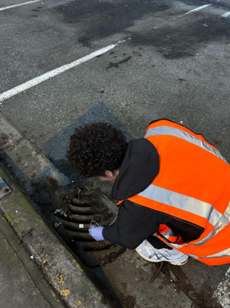
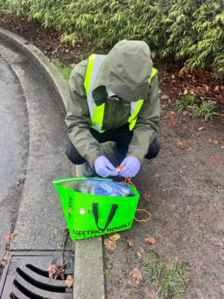
Figures 2 and 3: Sample collection at the residential site and the Science World parking lot industrial site.
Water quality was analyzed using DIPSTIK 1-18 Water quality test strips measuring for pH, total alkalinity, total hardness, zinc, free chlorine, iron, QAC and QUAT, copper, lead, mercury, nitrate, nitrite, total chlorine, manganese, sulfate, and fluoride. The test strip chart provided assigned value levels to colors instead of exact measurements, so results were recorded according to the closest matching color block on the chart. The main focus of the analysis was to compare whether industrial sites consistently differed from the residential, commercial, and comprehensive development sites.
Results
Table 1: Sampling results comparing comprehensive development, residential, commercial, and industrial sites after varying levels of precipitation.
| Site | Land use | Round | Date | Last precipitation period | Last precipitation amount (cm) | Time | pH | Total alkalinity (mg/L) | Total hardness (mg/L) | Zinc (mg/L) | Nitrate (mg/L) | Nitrite (mg/L) | Sulfate (mg/L) |
| Cambie & 41st | Comprehensive development | 1 | Feb 13, 2026 | Feb 13 | 1.2 | 1:30:00 PM | 6.2 | 0 | 25 | 0 | 0 | 0 | 800 |
| Cambie & 41st | Comprehensive development | 2 | Feb 21, 2026 | Feb 16 | 0.71 | 12:40:00 PM | 6.2 | 0 | 25 | 0 | 0 | 0 | 800 |
| East 37th & Prince Edward | Residential | 1 | Feb 13, 2026 | Feb 13 | 1.2 | 11:50:00 AM | 6.2 | 0 | 25 | 0 | 0 | 0 | 800 |
| East 37th & Prince Edward | Residential | 2 | Feb 21, 2026 | Feb 16 | 0.71 | 11:40:00 AM | 6.2 | 0 | 25 | 0 | 0 | 0 | 800 |
| Fraser & 39th | Commercial | 1 | Feb 13, 2026 | Feb 13 | 1.2 | 12:50:00 PM | 6.8 | 0 | 50 | 0 | 0 | 0 | 800 |
| Fraser & 39th | Commercial | 2 | Feb 21, 2026 | Feb 16 | 0.71 | 12:00:00 PM | 6.8 | 0 | 25 | 0 | 0 | 0 | 800 |
| Quebec St at Science World (road) | Industrial | 1 | Feb 18, 2026 | Feb 16 | 0.71 | 6:00:00 PM | 6.2 | 180 | 100 | 0 | 10 | 1 | 1200 |
| Quebec St at Science World (road) | Industrial | 2 | Feb 25, 2026 | Feb 22-23 | 2.921 | 6:00:00 PM | 6.2 | 180 | 100 | 0 | 10 | 1 | 1600 |
| Quebec St at Science World (under viaduct) | Industrial | 1 | Feb 18, 2026 | Feb 16 | 0.71 | 6:00:00 PM | 6.2 | 180 | 100 | 0 | 25 | 5 | 1600 |
| Quebec St at Science World (under viaduct) | Industrial | 2 | Feb 25, 2026 | Feb 22-23 | 2.921 | 6:00:00 PM | 6.2 | 180 | 100 | 0 | 10 | 1 | 1600 |
After recording the results, the most consistent pattern in the data was that the industrial sites had significantly worse stormwater runoff quality than the non-industrial sites. The data for comprehensive development, residential, and commercial sites were very similar to each other for nearly all measured attributes. These sites generally showed pH levels of 6.2, total alkalinity of 0 mg/L, total hardness of 25 or 50mg/L, and no zinc, free chlorine, iron, QAC and QUAT, copper, lead, mercury, nitrate, nitrite, total chlorine, manganese, and fluoride. Sulfate levels were consistently recorded at 800 mg/L for these non-industrial sites. The consistency across the non industrial land zones suggests that the runoff quality at these locations was stable under the conditions that samples were taken at.
In contrast, both industrial sites showed significantly higher values for several measured contaminants. The industrial samples consistently had a pH of 6.2, total alkalinity of 180 mg/L, total hardness of 100mg/L classifying it as hard water, nitrate levels of 10 or 25mg/L, nitrite levels of 1 or 5mg/L, and high amounts of sulfate measuring at around 1200-1600mg/L. zinc, chlorine, QAC and QUAT, copper, lead, mercury, and fluoride levels remained at 0mg/L. Industrial sites had much higher alkalinity, hardness, nitrate, nitrite, and sulfate levels, indicating that runoff from this zone has a higher concentration of pollutants.
Discussion
The results show a large differentiation between industrial and non industrial stormwater runoff. The comprehensive development, residential, and commercial sites share low contaminant readings with levels remaining relatively similar across all sites. Samples from industrial sites consistently presented elevated pollution levels, with most mineral parameters exceeding safe human consumption levels according to the strip analysis sheet. This pattern was repeated across both sampling rounds, suggesting that the observed differences were not caused by an isolated event. Samples were collected under dry and light rainfall conditions, with rainfall intensity assumed to be too minimal to produce significant variations in contaminant levels.
These findings suggest that stormwater quality in Vancouver does vary by land use, with the industrial sites showing the most evidence of poorer stormwater runoff quality. Samples from residential, commercial, and comprehensive development sites had extremely similar water chemistry and generally showed low readings for most measured parameters suggesting that runoff from these land use zones are not major sources of contamination. Both industrial sites showed higher values for total alkalinity, total hardness, nitrate, nitrite, and sulfate. This supports the idea that industrial land use is associated with more contaminated stormwater runoff than runoff from the other sampled land uses which aligns with the finding of Ahmed et al., 2019; Liang, 2018 and Popick et al., 2022.
Something important to take note of was the difference in nitrate and nitrite levels between industrial and non-industrial sites, with industrial sites showing a detectable amount of nitrate and nitrite, while all other sites did not contain any measurable traces of both contaminants. This suggests that industrial runoff contains more dissolved compounds related to surface contamination, due to higher vehicle activity observed on the Quebec Street site or materials washed from nearby hard surfaces in the case of both sampling sites. The higher nitrate levels from the second industrial site under the viaduct could also have been affected by runoff directly from the Vancouver SkyTrain rain tracks, as the catch basin was positioned directly under the supporting structure leaving it vulnerable to overhead drainage. Even though the measured values were not high, their exclusive prevalence at industrial sampling sites provides evidence indicating that stormwater runoff quality is significantly worse and more chemically potent in these areas.
The higher sulfate values at the industrial sites are also indicators of increased contamination. Sulfate can enter stormwater from atmospheric deposition, industrial materials, paved surfaces, and general chemical accumulation on impervious areas (Hatt et al., 2004). In this study, sulfate was consistently 800mg/L at the non-industrial sites but increased to 1200 or 1600mg/L at the industrial sites. That difference suggests that the industrial catch basins received runoff with a greater dissolved-solids load than the other sites. This pattern is consistent with previous stormwater studies by Teixidó et al., 2023 and Yazdi et al., 2021 showing that land use, especially industrial or heavily trafficked land, can increase the chemical load carried by urban runoff.
The higher total hardness and total alkalinity at the industrial sites further reinforce this pattern. Hardness is often associated with dissolved minerals such as calcium and magnesium, while alkalinity reflects the water’s ability to resist changes in pH (APHA, 2017). All non industrial sites showed an alkalinity of 0mg/L and hardness values of only 25 or 50mg/L, while the industrial sites showed an alkalinity of 180 mg/L and hardness of 100mg/L. These results suggest that the industrial runoff may have contained significantly more dissolved minerals, with stormwater chemistry often reflecting the materials that accumulate on nearby surfaces, and industrial surfaces may contribute more dissolved material than residential or commercial ones (Ahmed et al., 2019; Liang, 2018).
These findings have direct implications for Vancouvers aquatic ecosystems, particularly in False creek and the Fraser river where the untreated stormwater is being received directly through Storm water outfalls (Ahmed et al., 2019). Overall hard water with high levels of nitrate nitrite, and sulphate can trigger algal blooms and significant pH fluctuations in the water which can stress fish populations that are already vulnerable in urban waterways (Popick et al., 2022) Higher concentrations of dissolved minerals and nitrogen compounds in runoff causes eutrophication in the waterway which has been proven to reduce biodiversity by releasing high concentrations of pollutants that have been accumulated on impervious surfaces over dry periods which are most prevalent in industrial zones (Teixidó et al., 2023; Hall & Anderson, 1988)
Several limitations affected the reliability and scope of this experiment. The test strips used to analyze contaminant levels in water samples allowed for quantitative measurement, but were not fully accurate compared to a specialized tool and did not provide specific values, but instead relied on human interpretation to match colours to value ranges on a chart. Sampling was only conducted during the late winter and early spring period meaning that seasonal weather variances were missed such as winter road salt impacts, making the conclusions made only applicable to certain weather conditions. Additionally, only two rounds of samples were collected per site and most land use zones only had the representation of one site where samples were taken from, meaning that there were large generalizations made across the the variety of neighbourhoods and areas of Vancouver making the experiment unable to examine small variances within specific land use zones. Manual collection from catch basins without flow meters prevented volume based pollutant estimates, and the lack of replicates or controls increased error risk. Analyzing for contaminants and factors such as turbidity, suspended solids, bacteria, and PAHs also had to omitted due to the limitations of the test strips and lack of proper equipment.
Conclusion
This study found clear differences in stormwater quality across Vancouver land use zones, with industrial sites consistently showing higher total alkalinity (180 mg/L), total hardness (100 mg/L), nitrate (10-25 mg/L), nitrite (1-5 mg/L), and sulfate (1200-1600 mg/L) compared to residential, commercial, and comprehensive development sites, which contained low to zero levels of any measured contaminants, except for sulphate. These patterns were observed across both sampling rounds under similar climate conditions, indicating that industrial surfaces contribute more dissolved minerals and nitrogen compounds than other zones under the tested conditions.
The evidence supports former research claiming that land use as a factor of overall stormwater runoff quality, likely influenced by vehicle activity, and the accumulation of pollutants on impervious surfaces, and infrastructure like viaducts, but cannot quantify exact pollutant loads or prove causation without flow data or larger replication. The affect of these contaminants on receiving waters in False Creek or the Fraser river, and how seasonal variation factors such as the introduction of road salts were also not able to be answered in this small scale experiment, but With more time and resources, This experiment could be expanded by analyzing a larger amount of sampling sites over a longer period of time to cover seasonal variation with lab grade analysis tools for more specific data on contaminants to help influence Vancouver’s stormwater management priorities.
References
Ahmed, W., Hamilton, K., Toze, S., Cook, S., & Page, D. (2019). A review on microbial contaminants in stormwater runoff and outfalls: Potential health risks and mitigation strategies. The Science of the Total Environment, 692, 1304–1321. https://www.sciencedirect.com/science/article/abs/pii/S0048969719333340?via%3Dihub
APHA (American Public Health Association). (2017). Standard methods for the examination of water and wastewater (23rd ed.). American Public Health Association. https://www.scirp.org/reference/referencespapers?referenceid=2459667
Hatt, B. E., Fletcher, T. D., & Walsh, C. J. (2004). Hydrologic and pollutant removal performance of stormwater biofiltration systems at the field scale. Journal of Hydrology, 293(1-4), 92–111. https://www.sciencedirect.com/science/article/abs/pii/S0022169404000125?via%3Dihub
Hall, K. J., & Anderson, B. C. (1988). The toxicity and chemical composition of urban stormwater runoff. Canadian Journal of Fisheries and Aquatic Sciences, 45(2), 216–223. https://cdnsciencepub.com/doi/10.1139/f88-011
Liang, X. (2018). Stormwater analysis and water quality assessment of urban areas (Final Report FHWA-PA-2018-008-PIT WO 14). Commonwealth of Pennsylvania Department of Transportation. https://www.engineering.pitt.edu/contentassets/d720fbc5681f4f4eb048bb0b19bdd50e/stormwater_analysis_waterquality_assessment_urbanareas.pdf
Popick, H., Brinkmann, M., & McPhedran, K. (2022). Assessment of stormwater discharge contamination and toxicity for a cold-climate urban landscape. Environmental Sciences Europe, 34, 43. https://link.springer.com/article/10.1186/s12302-022-00619-x
Teixidó, M., Schmidlin, D., Xu, J., Scheiber, L., Chesa, M. J., & Vázquez-Suñé, E. (2023). Contaminants in urban stormwater: Barcelona case study. Advances in Geosciences, 59, 69–76. https://adgeo.copernicus.org/articles/59/69/2023/
Yazdi, S. K., Naghibi, M. C., & Liu, J. (2021). The effects of land use characteristics on urban stormwater quality and watershed pollutant loads. Science of the Total Environment, 772, 145504. https://www.sciencedirect.com/science/article/abs/pii/S0048969721005726?via%3Dihub